
Google Maps Just Launched Truck-Aware Routing That Knows About Low Bridges and Weight Limits. Here Is What It Means, and What It Does Not.
Google Maps Platform has released Large Vehicle Routing to help commercial fleets avoid low bridges and weight-restricted roads through specialized developer tools.
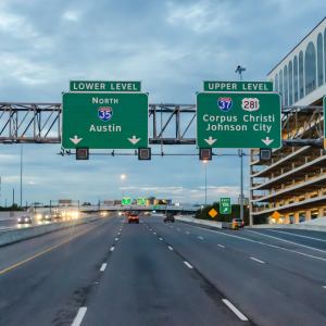
Google has launched Large Vehicle Routing to address the common industry problem of commercial drivers being misdirected by consumer-grade navigation apps. According to FreightWaves, this new technology is designed to prevent accidents such as bridge strikes and weight limit violations. By utilizing specialized road data, the system helps large vehicles navigate paths that are physically safe and legally compliant for their specific dimensions.
The technology is currently available as a suite of developer tools, including the Routes API and a Navigation SDK. Rather than a standalone mobile app for consumers, these components allow software companies to integrate truck-specific navigation into their own professional fleet management platforms. This allows for the creation of precise vehicle profiles that account for a truck's height, width, weight, axle count, and any hazardous materials on board.
The system provides updated arrival estimates based on observed truck speeds rather than passenger car traffic patterns. It also features a "route token" designed to synchronize the directions viewed by office dispatchers with what the driver sees on their in-cab display. Google Maps Platform product manager Mohit Moondra described the offering as a version of the company's routing technology built specifically for the requirements of commercial buses and trucks.
While the entry of a major technology firm into the trucking sector signals increased competition, the tools are intended to support rather than replace driver intuition. The new APIs aim to reduce the manual checks often required by fleet managers while improving overall safety. However, the practical benefits for most operators will depend on how quickly third-party telematics and dispatch software providers choose to incorporate these new Google capabilities into their products.
Editorial Desk — Trade Flow Insight. Reporting and market notes compiled by the Trade Flow Insight editorial team.
Related coverage

Elisabeth Braw: The Undersea War
A ship’s anchor can wreak havoc on the world’s undersea infrastructure, something that has provided plenty of rich material for Splash reporting in recent years. For Elisabeth Braw, the Cook Islands-flagged tanker Eagle S provides one of the most brazen examples. On Christmas Day 2024, the vessel was accused of dragging its anchor 90 km …
Borderlands Mexico: US takes 76% of vehicle exports as September shipments plunge
Borderlands Mexico is a weekly rundown of developments in the world of United States-Mexico cross-border trucking and trade. This week in Borderlands Mexico: US takes 76% of vehicle exports as September shipments plunge; DSV expands US-Mexico freight operations with McAllen office; and Texas university seeks $772,700 for AI-powered Laredo freight project. US takes 76% of vehicle exports as September shipments plunge More than three-quarters of Mexico’s light-vehicle exports were destined for the U.S. during the first nine months of 2026, underscoring the importance of cross-border automotive t

Oil Surges as Iran Tanker Attacks Escalate
Crude posted its biggest gain in a month amid Middle East tensions and hurricane-related production cuts.